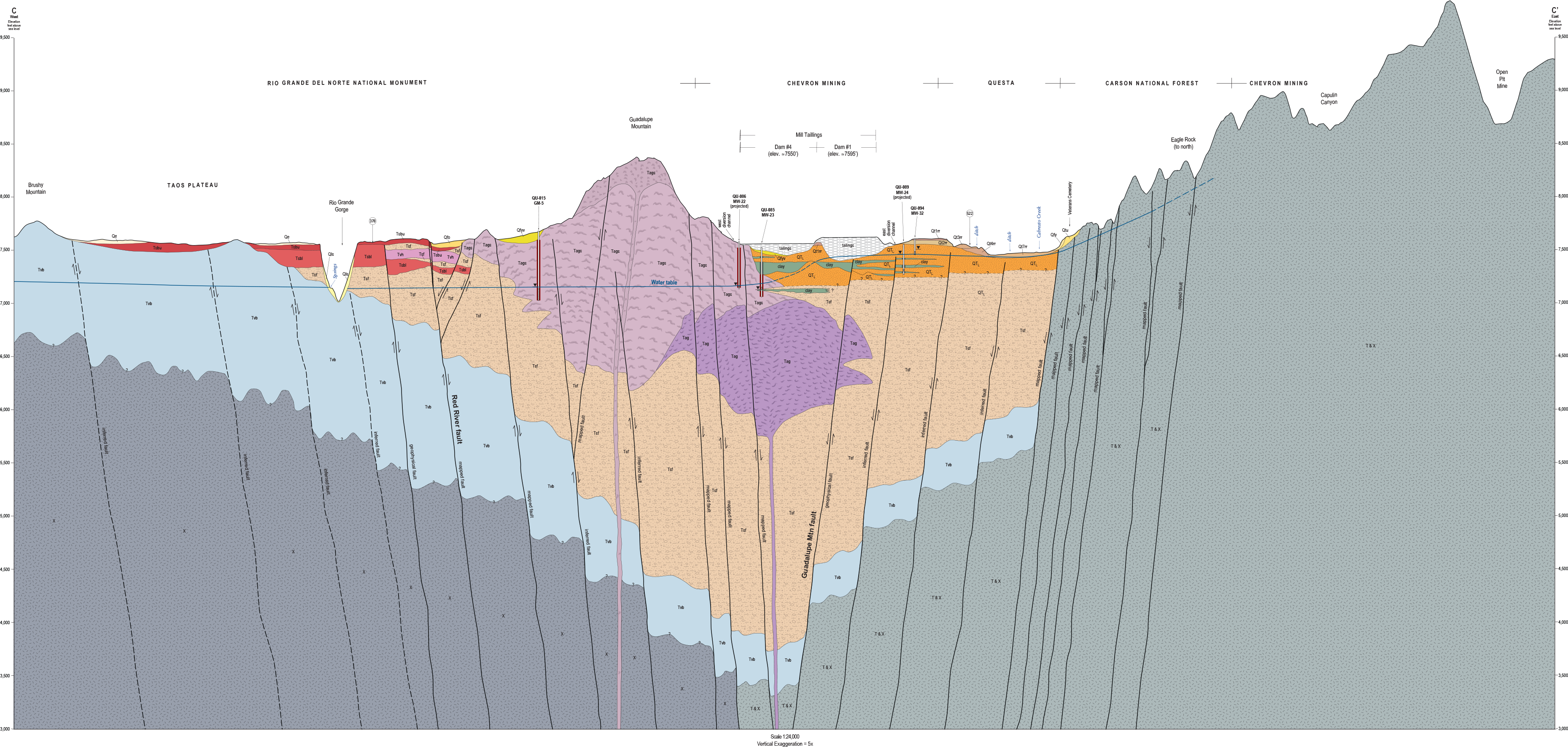
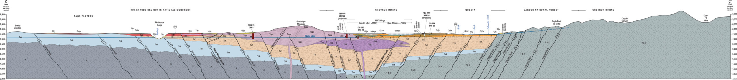
An integrated geologic/geophysical/hydrogeologic investigation of the Questa area was performed by the New Mexico Bureau of Geology & Mineral Resources (NMBG), the U.S. Geological Survey (USGS), and New Mexico Tech (NMT). The Final Technical Report, dated March 2015, describes the study and provides a road map to the accompanying files and diagrams.
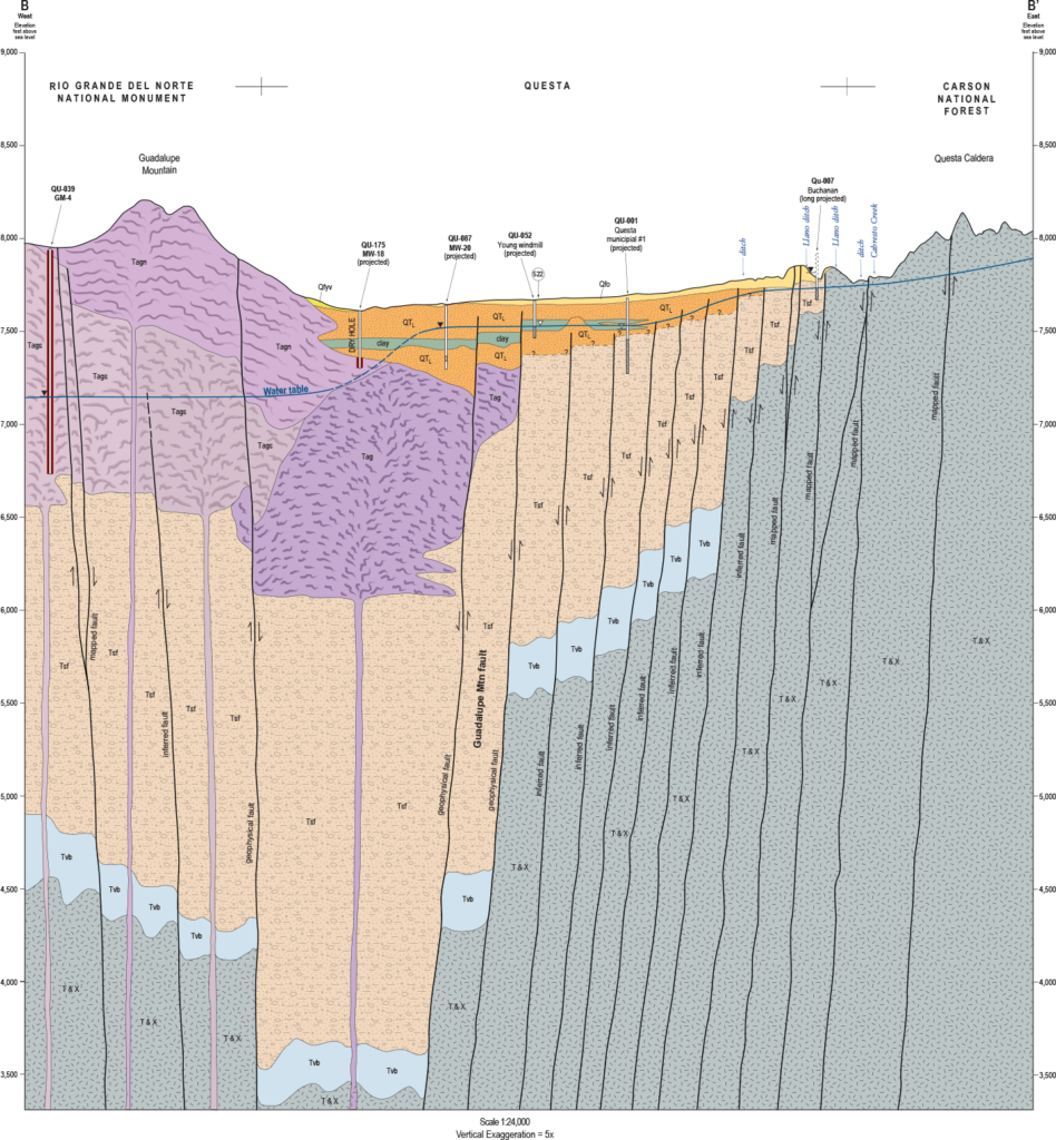
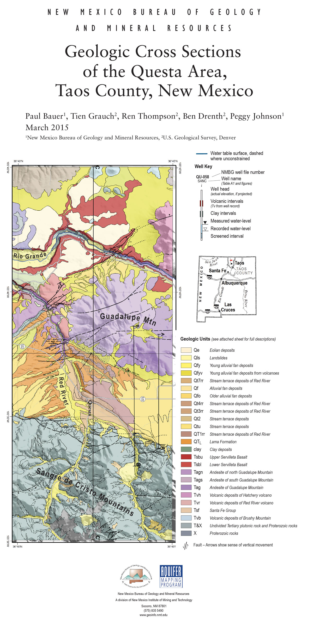
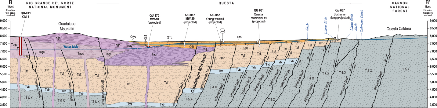
The objective of the study was to characterize and interpret the shallow three-dimensional geology and preliminary hydrogeology of the Questa area. The focus of the final report is to compile existing geologic and geophysical data, integrate new geophysical data, and interpret it in a geologic context in order to draw three, detailed geologic cross sections across the Questa area.
These cross sections can be used by the Village of Questa to make decisions about municipal water-well development, and can be used in the future to help in the development of a conceptual model of groundwater flow for the Questa area.
The NMBG was responsible for development of the geologic map and geologic cross sections. The USGS was responsible for developing a detailed geophysical model to be incorporated into the NMBG products. NMT was responsible for providing a graduate student to develop a geochemical and groundwater flow model. This report represents the final products for the geologic/geophysical investigation by the NMBG and the USGS.
Reports
(printouts available at Questa Public Library)
- Geologic Cross Sections of the Questa Area,
Taos County, New Mexico
Final Technical Report for the Village of Questa
March, 2015
by Paul W. Bauer and Peggy S. Johnson - Spring Inventory of the Questa Area (Table 2)
- Letter from Mayor Esther Garcia, June 8, 2021
Geological Maps and Legends
(printouts available at Questa Public Library)
(click image to enlarge)